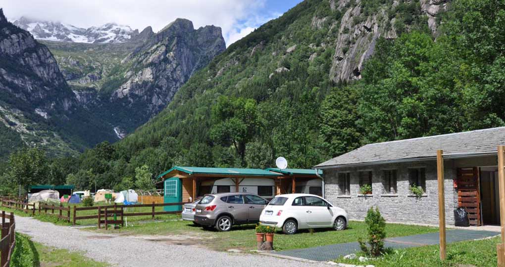
CAMPING SASSO REMENNO - Valmasino (Sondrio)
Great Overview And Tranquilly Surround our Camping
Activities and history of the Val Masino
TERRITORY
The Valley and its boundaries
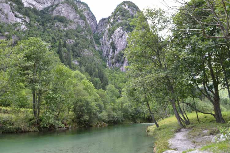
The mountains form the boundaries of the Val Masino, which is narrow southwards but enlarges and branches off eastwards and north-easterly in the Sasso Visolo and Preda Rossa Valleys and in the Val di Mello, westwards and northwards in the Bagni and Porcellizzo Valleys. The Valchiavenna is just beyond the ridge Mount Spluga - Cima Barbacane, and the Valmalenco can be reached by getting over the Corni Bruciati (Maroon horns) – Mount Disgrazia and Mount Sissone. To the north the national boundaries of the Rhaetian Alps (from Badile to peak Bondasca) divide the Val Masino and Italy from the Val Bregaglia – Switzerland. It originated from the Quaternary glaciation, which disclosed the Alps and the beautiful granite valleys surrounding them.
Luxuriant vegetation
The vegetation is typical of the Rhaetian side of the Alps with thick undergrowth, mainly chestnuts and beeches. The moist area of the Bagni Valley has allowed both the beech and the white fir to thrive. The red fir, which predominates at middle altitude, gives way to alpine pastures at high altitude. The highest valleys are subject to great changes in temperature. Due to this phenomenon, thickets of rhododendrons grow and grassland extends as far as the stony ground of the snowfields at high altitude. The highest point in the valley is Mount Disgrazia (3678m.)
Some geology
Geologically the Valley is divided into two areas: the one to the west is made of diorite and of ghiandone, a variety of granite, whereas the one to the east is made of serpentine. This serpentine is not green like the one you find in the neighbouring Valmalenco, but it is covered with a reddish patina due to weathering, which gave rise to the Corni Bruciati.
Among high peaks and snowfields
From San Martino you can see the Valley in its entirety, its green pastures, its alpine amphitheatres and its granite summits, which marked the history of modern mountaineering. Behind the village of San Martino, towards the east there is there is the beautiful and level Val di Mello, towards the north you can reach the Bagni Valley, where the Merdarola, Ligoncio and Porcellizzo Valleys join.
The carriage road continues towards the Bagni (Baths) bending at first among woods of firs and larches, then among woods of beeches. Next to the road you can see some granite quarries. Now we have reached the Bagni. Here the carriage road ends but just past the bridge there is the road leading to the thermal spring which has been famous since the 16th century. The paths leading to the refuges Omio (2108m.) and Gianetti (2534m.) branch off here, as well as the Sentiero Roma (Rome path), the “high way” of the Val Masino.
TOURISM
It is what is nowadays called sectoral tourism: thermal, naturalistic, cultural, artistic, gastronomic, linked to skiing, mountaineering and to the typical food and artisan productions. Tourism has been present in Valtellina for many centuries.
“In una valle chiamata la valle del Masxeno contigua agli alpi di Bregaglia è uno bagno assay caldo proximo a Morbegno e dodexe miglia, verso il quale si potria cavalcare assay comodamente” letter written by the podestà (the ancient mayor) of Morbegno in 1492 in order to induce the Duke of Milan to go to the Baths of Masino. In the past, tourists used to belong to the elite and they contributed to the spread of the bucolic and agricultural image of the Valtellina of the time. In Val Masino modern tourism started with the coming of mountaineering and after the conquest of some peaks in the valley by the English. Today, the lower Valtellina is not a destination for the masses, it is a limited phenomenon. Its peculiarities make it an unique environment which can fulfil various desires and expectations, among which the main are: every kind of mountaineering, alpine skiing, natural and artistic tourism, mountain biking, food and wine. Every visit is an unique discovery rich in fascinations and it turns into an everlasting memory.
EVENTS
The Great Race along the Sentiero Roma
The Kima trophy, the great race along the Sentiero Roma, takes place on the third Sunday of August in a landscape rich in extraordinary natural beauties. The course of this Marathon race at high altitude follows the famous Sentiero Roma. Both starting and arriving at Filorera (870m.), the course reaches the refuges Ponti, Allievi-Bonacossa, Gianetti, and Omio. Then it crosses the Bocchetta Roma and the Cameraccio, Torrone, Averta, Qualido, Camerozzo and Barbacane passes. From the Baths of Masino through the Piana di Bregolana the course now reaches San Martino and goes back to Filorera: altogether it is 48kms. and 203m. long, it has a height-difference amounting to 3650 metres with steep gradients and it crosses 7 passes which are all above 2500 metres. The highest spot is the Cameraccio pass (2590m.)
Alpine Guides: the great tradition
In the history of the Val Masino the year 1958 was dedicated to the Alpine Guides. You have to go back almost forty years to find the first annual meeting of the Alpine Guides of the Valley. The guides coming from Valtellina and representatives from all Lombardy used to be invited to this event, which took place for some years. Nowadays the Guides’ day commemorates the tragic death of a great guide. Therefore every year the association promoting the event awards a prize to the alpine guide member of the alpine rescue who has been the best at doing his task with commitment and devotion to the mountain. This event takes place together with the Kima trophy, the great race along the Sentiero Roma which is scheduled for the third Sunday of August.
![]()
![]()
Google-maps